Land-use Urban Planning and Transport Accessibility Indicator
End client
Department of Transport and Main Roads
Location
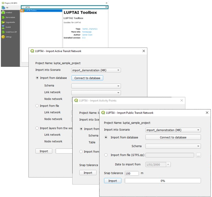
The LUPTAI model was initially developed by the Department of Transport and Main Roads (TMR) in 2005 to assist land use and transport planners with planning activities across the state. In 2020 TMR commissioned VLC to undertake software development and model improvements that would reduce complexity and make the software accessible to more people via the open source GIS software package QGIS.
Client requirements
TMR required a team of software developers and transport modellers to revalidate and calibrate the LUPTAI model, develop a LUPTAI plug-in for the non-proprietary software QGIS for distribution to users external to TMR, compile a database of activity points from open source data and improve model documentation and user guides outlining model methodology, software documentation and model execution.
Delivered outcome
The project delivered an easy-to-use plugin for the popular open-source GIS platform QGIS making LUPTAI accessible to more people. The core functionality of the accessibility computation was exposed through a Python API, unlocking the ability to directly integrate with the broader python data-science eco-system. VLC leveraged the Python API to develop a calibration module which utilises Jupyter notebooks to assess LUPTAI’s predictive power against other transport planning outcomes.
VLC also curated a set of open-source data from both government and public publication, allowing the creation of an unencumbered reference model, and reduced the learning curve with simplified online documentation.